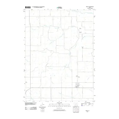
2010 Map of Menlo
USGS Topo · Published 2010About this map
Menlo serves as the primary hub of this Guthrie County landscape, located near the southern boundary of a region defined by a network of drainage ways. To the north, the small settlement of Glendon is situated near the curves of Beaver Creek, while the South Raccoon River marks the northernmost reaches of the survey. The terrain is characterized by its organized grid of rural roads, including Ranch Trl and Rose Ave, which connect several family and community landmarks. Genealogists will find notable value in the distribution of burial sites across the township, including Menlo Cemetery, Rosehill Cemetery, and the Quaker Cemetery to the west. Educational history is preserved at the site of the Morning Star School on Sycamore Ave, and the local civil center is noted by the Menlo Post Office. The drainage patterns here are complex, with Spring Branch and South Beaver Creek feeding into the larger river systems that move through this agricultural area.
Find a feature on this map
45 named features on this map. Tap any name to fly to it.
Don’t see what you’re looking for? This feature index may not catch every label — zoom into the map to look around manually.
Map Details
Editions of this 2010 Menlo Map
This is the sole edition of this map. No revisions or reprints were ever made.
Other maps of this area

1952 · Panora
USGS Topo · 1:62,500

1954 · Greenfield
USGS Topo · 1:62,500

1954 · Omaha
USGS Topo · 1:250,000

1957 · Omaha
USGS Topo · 1:250,000

1958 · Omaha
USGS Topo · 1:250,000

1971 · Canby
USGS Topo · 1:24,000

1971 · Casey
USGS Topo · 1:24,000

1971 · Guthrie Center West
USGS Topo · 1:24,000

1982 · Guthrie Center East
USGS Topo · 1:24,000

1982 · Panora
USGS Topo · 1:24,000