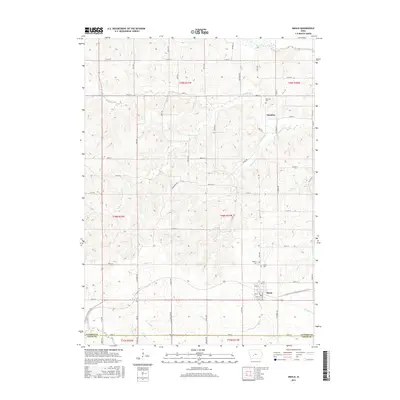
2015 Map of Menlo
USGS Topo · Published 2015About this map
Menlo and Glendon anchor this agricultural landscape in Guthrie and Adair Counties, where the terrain is deeply etched by a complex network of waterways. The northern edge is defined by the South Raccoon River, while the southern reaches are drained by the Middle River and N River. This 2015 survey illustrates a highly organized rural grid, where family-named roads like Pecan Ave and Oleander Trl divide the sectioned farmland. Local history is preserved in small communal sites such as Glendon Cem, Rosehill Cem, and Menlo Cem, which sit atop the rises overlooking the creek valleys. The drainage patterns of Beaver Cr and Plunger Cr dictate the winding paths of rural routes that break the otherwise rigid section lines, highlighting the persistence of natural hydrology in a heavily managed agrarian environment.
Find a feature on this map
62 named features on this map. Tap any name to fly to it.
Don’t see what you’re looking for? This feature index may not catch every label — zoom into the map to look around manually.
Map Details
Editions of this 2015 Menlo Map
This is the sole edition of this map. No revisions or reprints were ever made.
Other maps of this area

1952 · Panora
USGS Topo · 1:62,500

1954 · Greenfield
USGS Topo · 1:62,500

1954 · Omaha
USGS Topo · 1:250,000

1957 · Omaha
USGS Topo · 1:250,000

1958 · Omaha
USGS Topo · 1:250,000

1971 · Canby
USGS Topo · 1:24,000

1971 · Casey
USGS Topo · 1:24,000

1971 · Guthrie Center West
USGS Topo · 1:24,000

1982 · Guthrie Center East
USGS Topo · 1:24,000

1982 · Panora
USGS Topo · 1:24,000