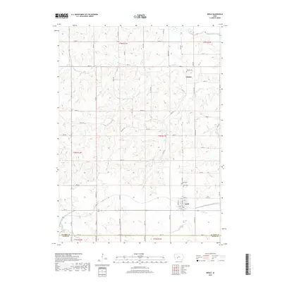
2018 Map of Menlo
USGS Topo · Published 2018About this map
The town of Menlo sits at the intersection of local routes and small-town infrastructure in Guthrie County, where the street grid is clearly defined by names like North St, 1st St, and 7th St. This landscape is deeply tied to its rural drainage patterns, with the South Raccoon River cutting across the northern reaches while the Middle River and N River frame the southern terrain. This topography, defined by numerous named tributaries like Plunger Cr and Deer Cr, illustrates the finely dissected plains of central Iowa. Historically significant sites for researchers include the Menlo Cem and Rosehill Cem located just north of the main settlement. Further north, the smaller community of Glendon is documented alongside the Glendon Cem, providing a detailed view of these established centers of local heritage and their surrounding agricultural land divisions.
Find a feature on this map
44 named features on this map. Tap any name to fly to it.
Don’t see what you’re looking for? This feature index may not catch every label — zoom into the map to look around manually.
Map Details
Editions of this 2018 Menlo Map
This is the sole edition of this map. No revisions or reprints were ever made.
Other maps of this area

1952 · Panora
USGS Topo · 1:62,500

1954 · Greenfield
USGS Topo · 1:62,500

1954 · Omaha
USGS Topo · 1:250,000

1957 · Omaha
USGS Topo · 1:250,000

1958 · Omaha
USGS Topo · 1:250,000

1971 · Canby
USGS Topo · 1:24,000

1971 · Casey
USGS Topo · 1:24,000

1971 · Guthrie Center West
USGS Topo · 1:24,000

1982 · Guthrie Center East
USGS Topo · 1:24,000

1982 · Panora
USGS Topo · 1:24,000