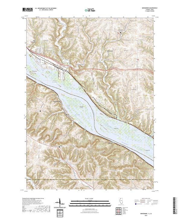
2024 Map of Menominee
USGS Topo · Published 2024About this map
The Mississippi River and its intricate network of sloughs and islands dominate this landscape on the Illinois-Iowa border. Centered on the community of Menominee, the terrain transitions from the high, dissected bluffs of Turkey Ridge down to the bottomlands of the Upper Mississippi River National Wildlife and Fish Refuge. The map details a corridor of river-dependent history, including the BNSF Railway tracks following the shoreline through East Dubuque and past the small riverside clusters of Shawondasse and Massey.
Find a feature on this map
80 named features on this map. Tap any name to fly to it.
Don’t see what you’re looking for? This feature index may not catch every label — zoom into the map to look around manually.
Map Details
Editions of this 2024 Menominee Map
This is the sole edition of this map. No revisions or reprints were ever made.
Other maps of this area

1900 · Lancaster
USGS Topo · 1:125,000

1901 · Peosta
USGS Topo · 1:125,000

1902 · Mineral Point
USGS Topo · 1:125,000

1904 · Lancaster
USGS Topo · 1:125,000

1908 · Lancaster
USGS Topo · 1:125,000

1911 · Galena
USGS Topo · 1:62,500

1913 · Galena
USGS Topo · 1:62,500

1935 · East Dubuque
USGS Topo · 1:62,500

1940 · East Dubuque
USGS Topo · 1:62,500

1952 · Cuba City
USGS Topo · 1:24,000