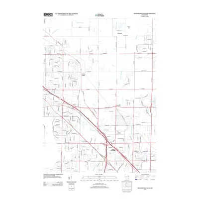
2013 Map of Menomonee Falls
USGS Topo · Published 2013About this map
The Menomonee River winds through this 2013 landscape, defining the character of a region where historic crossroads and suburban expansion meet. The map documents several established communities, including Freistadt to the north and the distinct settlements of Granville and West Granville. Local landmarks like the Barthel Fruit Farm reflect the area's agricultural roots, while the density of named residential streets around Victory Center and Fussville illustrates the modern development pattern characteristic of the Milwaukee suburbs.
Find a feature on this map
60 named features on this map. Tap any name to fly to it.
Don’t see what you’re looking for? This feature index may not catch every label — zoom into the map to look around manually.
Map Details
Editions of this 2013 Menomonee Falls Map
This is the sole edition of this map. No revisions or reprints were ever made.
Other maps of this area

1892 · Milwaukee
USGS Topo · 1:62,500

1892 · Waukesha
USGS Topo · 1:62,500

1892 · Port Washington
USGS Topo · 1:62,500

1901 · Milwaukee
USGS Topo · 1:62,500

1901 · Waukesha
USGS Topo · 1:62,500

1904 · West Bend
USGS Topo · 1:62,500

1904 · Port Washington
USGS Topo · 1:62,500

1906 · Waukesha
USGS Topo · 1:62,500

1906 · Milwaukee
USGS Topo · 1:62,500

1954 · Milwaukee
USGS Topo · 1:250,000