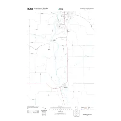
2013 Map of Menomonie South
USGS Topo · Published 2013About this map
The Red Cedar River carves a central path through this section of Dunn County, defining the valley landscape south of Menomonie. The settlement of Downsville sits at a significant bend in the river, where Wi-72 and State Road 25 intersect, serving as a focal point for the surrounding agricultural community. Further north along the river banks lies Irvington, positioned near the mouth of Irving Cr. A notable geological landmark, The Pinnacle, rises between the river and the western hills, overlooking the confluence with Little Elk Cr. The map details a well-established grid of country roads, such as County Hwy-D and County Hwy-K, which connect isolated farmsteads across the undulating terrain. To the north, the Menomonie City Landfill reflects more modern land use patterns near the edge of the city limits.
Find a feature on this map
72 named features on this map. Tap any name to fly to it.
Don’t see what you’re looking for? This feature index may not catch every label — zoom into the map to look around manually.
Map Details
Editions of this 2013 Menomonie South Map
This is the sole edition of this map. No revisions or reprints were ever made.
Other maps of this area

1929 · Durand
USGS Topo · 1:62,500

1932 · Durand
USGS Topo · 1:62,500

1935 · Arkansaw
USGS Topo · 1:48,000

1940 · Menomonie
USGS Topo · 1:62,500

1941 · Arkansaw
USGS Topo · 1:62,500

1942 · Arkansaw
USGS Topo · 1:62,500

1942 · Menomonie
USGS Topo · 1:62,500

1946 · Knapp
USGS Topo · 1:62,500

1949 · Knapp
USGS Topo · 1:62,500

1953 · Saint Paul
USGS Topo · 1:250,000