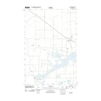
2010 Map of Mentor
USGS Topo · Published 2010About this map
The Mentor township and its surrounding lake district are defined by a high concentration of cemeteries and water bodies, reflecting a landscape long shaped by community and geography. This 2010 survey records the intricate shorelines of Maple Lake, Cable Lake, and Birch Lake, which dominate the southern half of the quadrangle. The settlement of Maple Bay sits along the southwestern edge of its namesake water, while the central town of Mentor houses the Mentor Post Office.
Find a feature on this map
22 named features on this map. Tap any name to fly to it.
Don’t see what you’re looking for? This feature index may not catch every label — zoom into the map to look around manually.
Map Details
Editions of this 2010 Mentor Map
This is the sole edition of this map. No revisions or reprints were ever made.
Other maps of this area

1918 · Terrebonne
USGS Topo · 1:62,500

1918 · Red Lake Falls
USGS Topo · 1:62,500

1919 · Valley
USGS Topo · 1:62,500

1952 · Red Lake Falls
USGS Topo · 1:62,500

1952 · Grand Forks
USGS Topo · 1:250,000

1956 · Grand Forks
USGS Topo · 1:250,000

1964 · Terrebonne
USGS Topo · 1:24,000

1964 · Brooks
USGS Topo · 1:24,000

1965 · Dugdale
USGS Topo · 1:24,000

1965 · Fertile
USGS Topo · 1:24,000