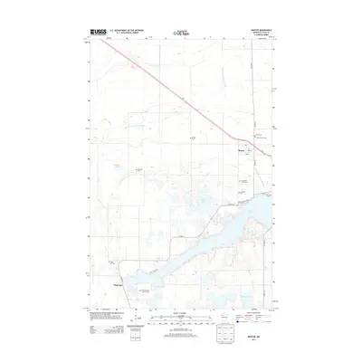
2013 Map of Mentor
USGS Topo · Published 2013About this map
Mentor serves as a small population hub in this Polk County landscape, situated along the northwestern corridor of Us-2. The area is defined by its numerous small lakes and a pervasive network of water management, evidenced by the prominent Judicial Ditch Number Sixtyfour and County Ditch Number Fourteen. To the south, the settlement of Maple Bay sits near the shores of Maple Lake, surrounded by a concentration of local history markers. This region is particularly notable for its high density of rural burial grounds, ranging from the Saint Lawrence Cem and Faith Cem near the town center to the Maple Bay Free Lutheran Cem further south. The map illustrates a transition from the agricultural plains to the lake-studded terrain that characterizes this part of Minnesota, where local roads like Maple Lake DR Se and Sandy Beach RD Se provide access to the waterfront communities.
Find a feature on this map
26 named features on this map. Tap any name to fly to it.
Don’t see what you’re looking for? This feature index may not catch every label — zoom into the map to look around manually.
Map Details
Editions of this 2013 Mentor Map
This is the sole edition of this map. No revisions or reprints were ever made.
Other maps of this area

1918 · Terrebonne
USGS Topo · 1:62,500

1918 · Red Lake Falls
USGS Topo · 1:62,500

1919 · Valley
USGS Topo · 1:62,500

1952 · Red Lake Falls
USGS Topo · 1:62,500

1952 · Grand Forks
USGS Topo · 1:250,000

1956 · Grand Forks
USGS Topo · 1:250,000

1964 · Terrebonne
USGS Topo · 1:24,000

1964 · Brooks
USGS Topo · 1:24,000

1965 · Dugdale
USGS Topo · 1:24,000

1965 · Fertile
USGS Topo · 1:24,000