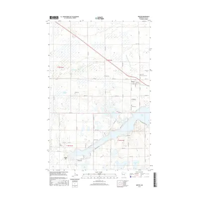
2016 Map of Mentor
USGS Topo · Published 2016About this map
Mentor serves as the central hub of this Polk County landscape, situated where the railway corridors meet the northern shores of Maple Lake. The area's settlement history is clearly visible through a dense concentration of local burial grounds, including the Saint Lawrence Cem and Faith Cem near the town center, and the Hitterdal Cem to the west. These sites, along with the First English Lutheran Cem and Lakeside Cem, suggest a well-established community structure deeply rooted in the surrounding prairie and lakeside terrain.
Find a feature on this map
42 named features on this map. Tap any name to fly to it.
Don’t see what you’re looking for? This feature index may not catch every label — zoom into the map to look around manually.
Map Details
Editions of this 2016 Mentor Map
This is the sole edition of this map. No revisions or reprints were ever made.
Other maps of this area

1918 · Terrebonne
USGS Topo · 1:62,500

1918 · Red Lake Falls
USGS Topo · 1:62,500

1919 · Valley
USGS Topo · 1:62,500

1952 · Red Lake Falls
USGS Topo · 1:62,500

1952 · Grand Forks
USGS Topo · 1:250,000

1956 · Grand Forks
USGS Topo · 1:250,000

1964 · Terrebonne
USGS Topo · 1:24,000

1964 · Brooks
USGS Topo · 1:24,000

1965 · Dugdale
USGS Topo · 1:24,000

1965 · Fertile
USGS Topo · 1:24,000