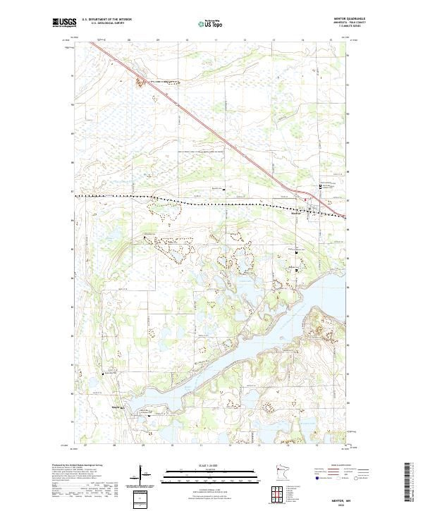
2022 Map of Mentor
USGS Topo · Published 2022About this map
The glacial landscape of central Polk County is defined by its numerous wetlands and deep blue lakes, with Maple Lake and Cable Lake anchoring the local topography. This 2022 survey shows a region deeply connected to its Lutheran and Catholic roots, evidenced by the high density of rural burial grounds such as Faith Lutheran Cem and Saint Lawrence Catholic Cem. The settlement of Mentor serves as a small hub at the intersection of Co HWY 10 and Co RD 45, while the community of Maple Bay sits further south near the shores of its namesake water body.
Find a feature on this map
59 named features on this map. Tap any name to fly to it.
Don’t see what you’re looking for? This feature index may not catch every label — zoom into the map to look around manually.
Map Details
Editions of this 2022 Mentor Map
This is the sole edition of this map. No revisions or reprints were ever made.
Other maps of this area

1918 · Terrebonne
USGS Topo · 1:62,500

1918 · Red Lake Falls
USGS Topo · 1:62,500

1919 · Valley
USGS Topo · 1:62,500

1952 · Red Lake Falls
USGS Topo · 1:62,500

1952 · Grand Forks
USGS Topo · 1:250,000

1956 · Grand Forks
USGS Topo · 1:250,000

1964 · Terrebonne
USGS Topo · 1:24,000

1964 · Brooks
USGS Topo · 1:24,000

1965 · Dugdale
USGS Topo · 1:24,000

1965 · Fertile
USGS Topo · 1:24,000