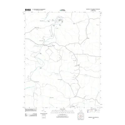
2012 Map of Meramec State Park
USGS Topo · Published 2012About this map
The Meramec River winds through this landscape, defining a region where dense conservation forests meet small valley settlements. Along its banks, features such as La Jolla Spring, Fife Bottom, and New Beach point to a long history of river-based activity. To the south, the terrain becomes more defined by ridges and hollows, such as Primrose Hollow and Greens Hollow, where the community of Pea Ridge sits near its namesake Pea Ridge Cemetery. The map captures industrial and civic history through the Old Hamilton Works and the Reedville School, while the Kelleter Lookout Tower near Hulsey stands as a prominent landmark for forest management. This network of springs, fords like Garrett Ford, and gaps reveals how the local topography has dictated travel and settlement patterns throughout the area.
Find a feature on this map
70 named features on this map. Tap any name to fly to it.
Don’t see what you’re looking for? This feature index may not catch every label — zoom into the map to look around manually.
Map Details
Editions of this 2012 Meramec State Park Map
This is the sole edition of this map. No revisions or reprints were ever made.
Other maps of this area

1901 · De Soto
USGS Topo · 1:125,000

1903 · Sullivan
USGS Topo · 1:125,000

1934 · Meramec State Park
USGS Topo · 1:24,000

1937 · Meramec State Park
USGS Topo · 1:24,000

1946 · Richwoods
USGS Topo · 1:62,500

1946 · Union
USGS Topo · 1:62,500

1947 · Sullivan
USGS Topo · 1:62,500

1947 · St. Clair
USGS Topo · 1:62,500

1948 · Richwoods
USGS Topo · 1:62,500

1948 · Union
USGS Topo · 1:62,500