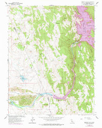
1962 Map of Merced Falls
USGS Topo · Published 1978About this map
Industrial and hydraulic engineering define the landscape along the Merced River in this mid-century survey. The settlement at Merced Falls serves as a focal point for water management, featuring the Merced Falls Diversion Dam, a powerhouse, and a substation. Extensive Dredge Tailings along the river banks below the falls reveal the intensive gold dredging history of the region.
Find a feature on this map
37 named features on this map. Tap any name to fly to it.
Don’t see what you’re looking for? This feature index may not catch every label — zoom into the map to look around manually.
Map Details
Editions of this 1962 Merced Falls Map
2 editions found
Other maps of this area

1893 · Sonora
USGS Topo · 1:125,000

1896 · Sonora
USGS Topo · 1:125,000

1897 · Sonora
USGS Topo · 1:125,000

1898 · Sonora
USGS Topo · 1:125,000

1915 · La Grange
USGS Topo · 1:24,000

1916 · Hopeton
USGS Topo · 1:31,680

1916 · Merced Falls
USGS Topo · 1:24,000
1918 · Snelling
USGS Topo · 1:31,680

1919 · Indian Gulch
USGS Topo · 1:48,000

1919 · Haystack Mountain
USGS Topo · 1:31,680