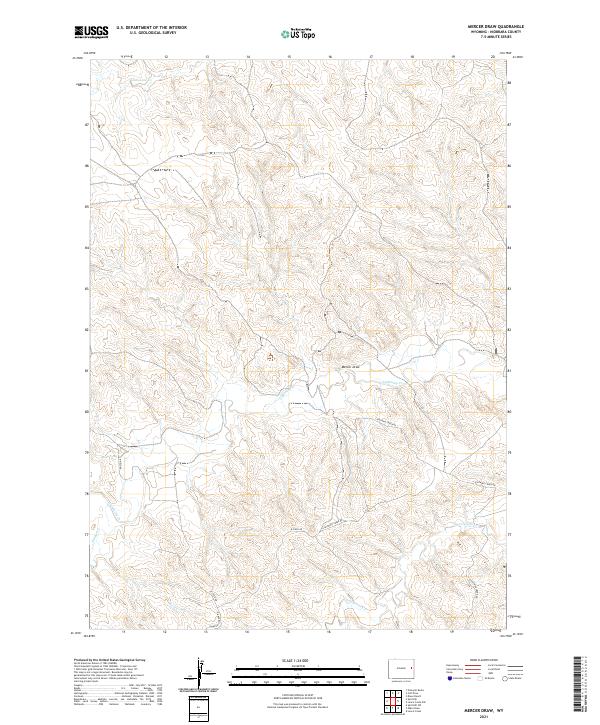
2021 Map of Mercer Draw
USGS Topo · Published 2021About this map
Mercer Draw carves a distinct path through this Niobrara County landscape, serving as a central drainage feature in an area defined by its intermittent watercourses and ranch-land infrastructure. The terrain is structured by several key seasonal streams, including the winding Lightning Cr and its tributaries like Twentymile Cr and Little Cow Cr. These water sources are critical to the character of the region, where the vastness of the plains is punctuated by the occasional crossing of remote access routes such as Lightning Creek Rd and K-Field Rd. The map illustrates a classic Wyoming ranching environment, where township and range lines like t37n r66w provide the primary organizational grid for land ownership and resource management. The lack of concentrated settlements highlights the expansive, open-range nature of this part of the state in the early twenty-first century.
Find a feature on this map
13 named features on this map. Tap any name to fly to it.
Don’t see what you’re looking for? This feature index may not catch every label — zoom into the map to look around manually.
Map Details
Editions of this 2021 Mercer Draw Map
This is the sole edition of this map. No revisions or reprints were ever made.
Other maps of this area

1955 · Newcastle
USGS Topo · 1:250,000

1958 · Newcastle
USGS Topo · 1:250,000

1981 · Calf Draw
USGS Topo · 1:24,000

1981 · Mercer Draw
USGS Topo · 1:24,000

1981 · Pinnacle Rocks
USGS Topo · 1:24,000

1981 · Dixon Ranch
USGS Topo · 1:24,000

1981 · Lance Creek NW
USGS Topo · 1:24,000
1981 · Split Hill SW
USGS Topo · 1:24,000
1981 · Lance Creek
USGS Topo · 1:24,000
1981 · Mikes Draw
USGS Topo · 1:24,000