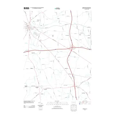
2013 Map of Mercer
USGS Topo · Published 2013About this map
Mercer serves as the primary hub of this area, where a grid of streets including W Market St and E Butler St forms the community's core. The landscape is defined by the branching waters of Neshannock Cr, which winds south past Oakland toward Hope Mills. The distribution of small settlements like Pardoe, Blacktown, and Irishtown suggests a long history of rural development tied to the region's stream valleys and early transport corridors.
Find a feature on this map
111 named features on this map. Tap any name to fly to it.
Don’t see what you’re looking for? This feature index may not catch every label — zoom into the map to look around manually.
Map Details
Editions of this 2013 Mercer Map
This is the sole edition of this map. No revisions or reprints were ever made.
Other maps of this area

1905 · Neshannock
USGS Topo · 1:62,500

1907 · Neshannock
USGS Topo · 1:62,500

1908 · Shenango
USGS Topo · 1:62,500

1911 · Stoneboro
USGS Topo · 1:62,500

1913 · Stoneboro
USGS Topo · 1:62,500

1913 · Mercer
USGS Topo · 1:62,500

1939 · Mercer
USGS Topo · 1:62,500

1943 · Mercer
USGS Topo · 1:62,500

1943 · Stoneboro
USGS Topo · 1:62,500

1950 · Cleveland
USGS Topo · 1:250,000
Featured Places
- Mercer, PA
- Jackson Township, PA
- Pardoe, Findley Township
- East Lackawannock Township, PA
- Five Points, Findley Township