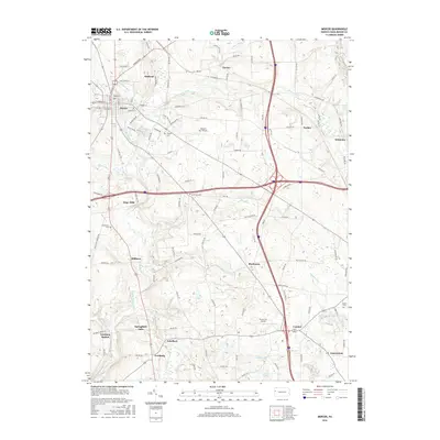
2016 Map of Mercer
USGS Topo · Published 2016About this map
Mercer serves as the focal point of this Pennsylvania landscape, where a dense street grid including W Market St and E Beaver St anchors the surrounding rural townships. The map documents a transition from the structured borough to the rolling topography shaped by Neshannock Creek and its many tributaries like Pine Run and Munnell Run. Small named settlements and hamlets are frequent throughout the quadrangle, including Pardoe, Blacktown, and Leesburg Station, providing a detailed look at the modern distribution of Mercer County's community centers.
Find a feature on this map
106 named features on this map. Tap any name to fly to it.
Don’t see what you’re looking for? This feature index may not catch every label — zoom into the map to look around manually.
Map Details
Editions of this 2016 Mercer Map
This is the sole edition of this map. No revisions or reprints were ever made.
Other maps of this area

1905 · Neshannock
USGS Topo · 1:62,500

1907 · Neshannock
USGS Topo · 1:62,500

1908 · Shenango
USGS Topo · 1:62,500

1911 · Stoneboro
USGS Topo · 1:62,500

1913 · Stoneboro
USGS Topo · 1:62,500

1913 · Mercer
USGS Topo · 1:62,500

1939 · Mercer
USGS Topo · 1:62,500

1943 · Mercer
USGS Topo · 1:62,500

1943 · Stoneboro
USGS Topo · 1:62,500

1950 · Cleveland
USGS Topo · 1:250,000
Featured Places
- Mercer, PA
- Jackson Township, PA
- Pardoe, Findley Township
- East Lackawannock Township, PA
- Five Points, Findley Township