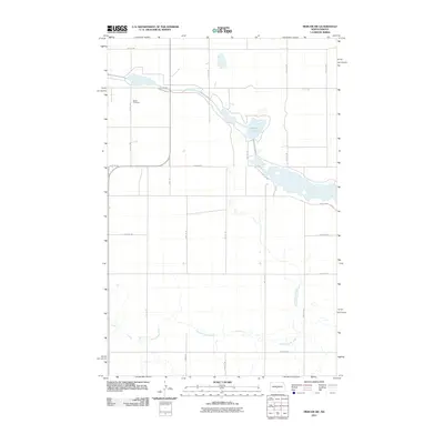
2011 Map of Mercer SW
USGS Topo · Published 2011About this map
Bethel Cemetery sits on a quiet rise in Burleigh County, marking a site of local heritage within a landscape shaped by glacial waters and modern agricultural transit. The terrain is defined by the winding course of Painted Woods Creek in the south and the prominent presence of Heckers Lake to the north. This 2011 survey reveals a transition in the local infrastructure, where the established path of County Hwy 20 and New Johns Lake Rd provides access to the diverse water bodies. The map captures the rectilinear grid of section lines and gravel roads, such as 8th Ave SW and 471st Ave NE, which organize the prairie into a productive network of farms and fields typical of central North Dakota.
Find a feature on this map
22 named features on this map. Tap any name to fly to it.
Don’t see what you’re looking for? This feature index may not catch every label — zoom into the map to look around manually.
Map Details
Editions of this 2011 Mercer SW Map
This is the sole edition of this map. No revisions or reprints were ever made.
Other maps of this area

1949 · Turtle Creek
USGS Topo · 1:62,500

1950 · Wilton
USGS Topo · 1:62,500

1954 · McClusky
USGS Topo · 1:250,000

1958 · McClusky
USGS Topo · 1:250,000

1959 · Pickardville
USGS Topo · 1:24,000

1959 · Mercer
USGS Topo · 1:24,000

1959 · Mercer SW
USGS Topo · 1:24,000

1959 · Mercer SE
USGS Topo · 1:24,000

1961 · Turtle Creek NE
USGS Topo · 1:24,000

1961 · Turtle Creek SE
USGS Topo · 1:24,000