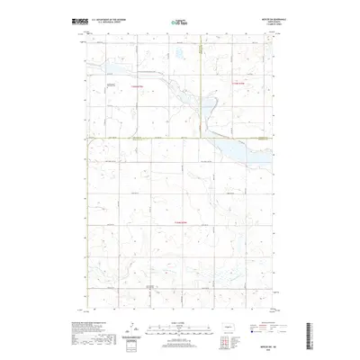
2020 Map of Mercer SW
USGS Topo · Published 2020About this map
The rolling prairie landscape at the junction of Burleigh, McLean, and Sheridan Counties is defined by the winding course of the N Country National Scenic Trail. This modern topographic study reveals a rural expanse dominated by seasonal wetlands and small water bodies, most notably Heckers Lake in the north. The area's cultural history is anchored by its rural cemeteries, including the Bethel United Methodist Cem and the Saint Nickolas Ukrainian Cem, reflecting the diverse immigrant heritage of North Dakota's farming communities. To the south, the terrain descends into the drainage of Painted Woods Cr, while a precise grid of section-line roads such as 471st Ave NE and New Johns Lake Rd organizes the township layout of T144N R79W and T145N R79W.
Find a feature on this map
22 named features on this map. Tap any name to fly to it.
Don’t see what you’re looking for? This feature index may not catch every label — zoom into the map to look around manually.
Map Details
Editions of this 2020 Mercer SW Map
This is the sole edition of this map. No revisions or reprints were ever made.
Other maps of this area

1949 · Turtle Creek
USGS Topo · 1:62,500

1950 · Wilton
USGS Topo · 1:62,500

1954 · McClusky
USGS Topo · 1:250,000

1958 · McClusky
USGS Topo · 1:250,000

1959 · Pickardville
USGS Topo · 1:24,000

1959 · Mercer
USGS Topo · 1:24,000

1959 · Mercer SW
USGS Topo · 1:24,000

1959 · Mercer SE
USGS Topo · 1:24,000

1961 · Turtle Creek NE
USGS Topo · 1:24,000

1961 · Turtle Creek SE
USGS Topo · 1:24,000