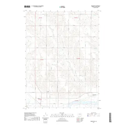
2017 Map of Merchiston
USGS Topo · Published 2017About this map
The Loup River and Cedar River converge at the southwestern edge of this Nance County landscape, anchoring the city of Fullerton. This confluence area has long defined the local geography, with the rivers cutting through a terrain of dissected uplands drained by numerous smaller waterways. To the east, the small settlement of Merchiston sits near the banks of the Plum Cr, which winds through the central portion of the quadrangle. North of the river valley, the land is characterized by a dense network of sectional roads and varied topography, including the Hasselbach Reservoir and several named creeks such as Council Cr and Skeedee Cr. Aviation history is noted by the presence of CAMP Airport located just north of the river. The map illustrates a strictly rural economy, where the grid-based road system provides access to the undulating hills between the major river valleys.
Find a feature on this map
38 named features on this map. Tap any name to fly to it.
Don’t see what you’re looking for? This feature index may not catch every label — zoom into the map to look around manually.
Map Details
Editions of this 2017 Merchiston Map
This is the sole edition of this map. No revisions or reprints were ever made.
Other maps of this area

1896 · Stromsburg
USGS Topo · 1:125,000

1899 · St. Paul
USGS Topo · 1:125,000

1954 · Belgrade
USGS Topo · 1:24,000

1954 · Cedar Rapids SE
USGS Topo · 1:24,000

1955 · Broken Bow
USGS Topo · 1:250,000

1955 · Belgrade SE
USGS Topo · 1:24,000

1955 · Fremont
USGS Topo · 1:250,000

1956 · Broken Bow
USGS Topo · 1:250,000

1957 · Fremont
USGS Topo · 1:250,000

1958 · Fremont
USGS Topo · 1:250,000