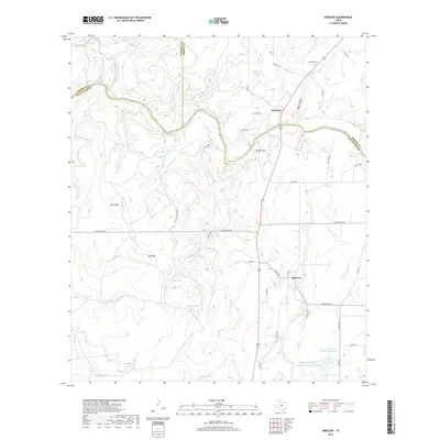
2019 Map of Mercury
USGS Topo · Published 2019About this map
The Colorado River defines the convergence of McCulloch, Brown, and Coleman Counties, winding through a landscape of high ridges and managed water resources. Small settlements like Winchell and Mercury anchor the local road network, while the rugged topography is marked by prominent elevations such as Morgan Mtn and Lost Mtn. Genealogists will find the locations of Winchell Cem and Cox Cem particularly valuable for tracing local family histories in this rural stretch of Central Texas.
Find a feature on this map
51 named features on this map. Tap any name to fly to it.
Don’t see what you’re looking for? This feature index may not catch every label — zoom into the map to look around manually.
Map Details
Editions of this 2019 Mercury Map
This is the sole edition of this map. No revisions or reprints were ever made.
Other maps of this area

1887 · Coleman
USGS Topo · 1:125,000

1889 · Coleman
USGS Topo · 1:125,000

1894 · Brady
USGS Topo · 1:125,000

1924 · Brady 2-a
USGS Topo · 1:48,000

1925 · Brady 1-b
USGS Topo · 1:48,000

1925 · Brady 1-a
USGS Topo · 1:48,000

1928 · Mercury
USGS Topo · 1:62,500

1928 · Waldrip
USGS Topo · 1:62,500

1950 · Mercury
USGS Topo · 1:62,500

1954 · Brownwood
USGS Topo · 1:250,000