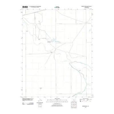
2010 Map of Meredith Hill
USGS Topo · Published 2010About this map
Meredith Hill rises as a prominent landmark in this dry corner of Otero County, where life and geography are defined by a sophisticated system of water management. The landscape is a network of engineered irrigation, featuring the Horse Creek and Black Draw Ditch, the Fort Lyon Storage Canal, and the Lake Canal. Central to this system is the Horse Creek and Black Draw Reservoir, held by the Horse Creek and Black Draw Dam, which supports the agricultural operations scattered throughout the plains.
Find a feature on this map
33 named features on this map. Tap any name to fly to it.
Don’t see what you’re looking for? This feature index may not catch every label — zoom into the map to look around manually.
Map Details
Editions of this 2010 Meredith Hill Map
This is the sole edition of this map. No revisions or reprints were ever made.
Other maps of this area

1891 · Catlin
USGS Topo · 1:125,000

1891 · Las Animas
USGS Topo · 1:125,000

1893 · Las Animas
USGS Topo · 1:125,000

1893 · Catlin
USGS Topo · 1:125,000

1953 · Cheraw
USGS Topo · 1:24,000

1953 · Hadley
USGS Topo · 1:24,000

1954 · Meredith Hill
USGS Topo · 1:24,000

1954 · Sugar City
USGS Topo · 1:24,000

1954 · Lamar
USGS Topo · 1:250,000

1955 · Rocky Ford
USGS Topo · 1:24,000