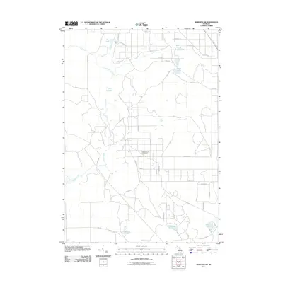
2011 Map of Meredith NW
USGS Topo · Published 2011About this map
Headquarters Oil and Gas Field centers this Michigan landscape, marking a significant industrial presence amidst the wooded terrain of Roscommon County. The area is defined by a dense network of water bodies and drainage systems, including the northern Pup Lake and Duck Lake, which feed into the meandering Wolf Creek and its various branches. To the south, larger water features like Rollway Lake, Elbow Lake, and Tuohy Lake create a distinct geographic cluster. The settlement of Nokomis Camp sits near the northern boundary, connected by a grid of rural routes such as Waco Rd and Reserve Rd. This 2011 survey illustrates the modern intersection of natural hydrology and resource extraction, where secondary roads like Market Rd and Pulp Rd provide access to the oil and gas operations and the surrounding timberlands.
Find a feature on this map
59 named features on this map. Tap any name to fly to it.
Don’t see what you’re looking for? This feature index may not catch every label — zoom into the map to look around manually.
Map Details
Editions of this 2011 Meredith NW Map
This is the sole edition of this map. No revisions or reprints were ever made.
Other maps of this area

1954 · Traverse City
USGS Topo · 1:250,000

1956 · Houghton Lake
USGS Topo · 1:62,500

1957 · Harrison
USGS Topo · 1:62,500

1958 · Traverse City
USGS Topo · 1:250,000

1963 · Backus Lake
USGS Topo · 1:24,000

1963 · Prudenville
USGS Topo · 1:24,000

1969 · Meredith NW
USGS Topo · 1:24,000

1969 · Meredith
USGS Topo · 1:24,000

1969 · Meredith SW
USGS Topo · 1:24,000
1969 · Skeels
USGS Topo · 1:24,000