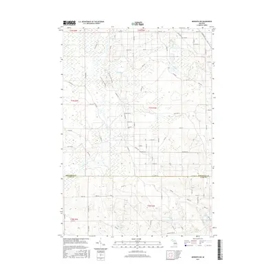
2017 Map of Meredith NW
USGS Topo · Published 2017About this map
The wetland-rich landscape of Roscommon and Clare Counties is defined by a dense network of glacial lakes and shifting creek systems as they appeared in 2017. Numerous small water bodies, including Boyce Lake, Duck Lake, and the larger Rollway Lake, are scattered across the terrain, connected by the meandering paths of Wolf Creek and its tributary, East Branch Wolf Creek. The presence of Townline Creek and Pup Lake further illustrates the low-lying, hydrologically complex nature of this North-Central Michigan region.
Find a feature on this map
58 named features on this map. Tap any name to fly to it.
Don’t see what you’re looking for? This feature index may not catch every label — zoom into the map to look around manually.
Map Details
Editions of this 2017 Meredith NW Map
This is the sole edition of this map. No revisions or reprints were ever made.
Other maps of this area

1954 · Traverse City
USGS Topo · 1:250,000

1956 · Houghton Lake
USGS Topo · 1:62,500

1957 · Harrison
USGS Topo · 1:62,500

1958 · Traverse City
USGS Topo · 1:250,000

1963 · Backus Lake
USGS Topo · 1:24,000

1963 · Prudenville
USGS Topo · 1:24,000

1969 · Meredith NW
USGS Topo · 1:24,000

1969 · Meredith
USGS Topo · 1:24,000

1969 · Meredith SW
USGS Topo · 1:24,000
1969 · Skeels
USGS Topo · 1:24,000