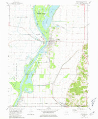
1980 Map of Meredosia
USGS Topo · Published 1981About this map
The Illinois River dominates this landscape at the intersection of Morgan, Pike, Scott, and Brown counties, where a complex network of levees and backwater lakes defines the river valley. The river’s path is flanked by expansive islands including Wilsons Island and Eagle Island, which form the core of the Meredosia National Wildlife Refuge. This environment supported a specialized river economy, evidenced by the numerous sandpits and settling ponds located near the town of Meredosia.
Find a feature on this map
45 named features on this map. Tap any name to fly to it.
Don’t see what you’re looking for? This feature index may not catch every label — zoom into the map to look around manually.
Map Details
Editions of this 1980 Meredosia Map
This is the sole edition of this map. No revisions or reprints were ever made.
Other maps of this area

1924 · Winchester
USGS Topo · 1:48,000

1924 · Griggsville
USGS Topo · 1:62,500

1926 · Griggsville
USGS Topo · 1:62,500

1926 · Winchester
USGS Topo · 1:62,500

1928 · Meredosia
USGS Topo · 1:62,500

1929 · Arenzville
USGS Topo · 1:62,500

1931 · Meredosia
USGS Topo · 1:62,500

1932 · Arenzville
USGS Topo · 1:62,500

1948 · Quincy
USGS Topo · 1:250,000

1956 · Quincy
USGS Topo · 1:250,000