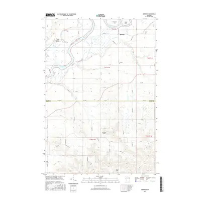
2015 Map of Meridean
USGS Topo · Published 2015About this map
The Chippewa River dominates this landscape on the border of Dunn and Pepin counties, creating a complex network of waterways including the Meridean Slu and several distinctive landforms like Chippewa Island and Happy Island. Near the settlement of Meridean, the terrain transitions from the low-lying Upper Dunnville Bottoms to the more varied topography of Prissel Valley in the south. This area is characterized by a mix of agricultural plots and drainage systems such as Cranberry Cr and Fall Cr. Local history and genealogy interest is anchored by several established burial grounds, including Fossum Cem, Peru Cem, and Holy Rosary Cem. The presence of the Hayes Road Airport reflects the rural aviation infrastructure of this Wisconsin river valley region.
Find a feature on this map
68 named features on this map. Tap any name to fly to it.
Don’t see what you’re looking for? This feature index may not catch every label — zoom into the map to look around manually.
Map Details
Editions of this 2015 Meridean Map
This is the sole edition of this map. No revisions or reprints were ever made.
Other maps of this area

1929 · Durand
USGS Topo · 1:62,500

1932 · Durand
USGS Topo · 1:62,500

1932 · Mondovi
USGS Topo · 1:62,500

1934 · Elk Mound
USGS Topo · 1:62,500

1936 · Elk Mound
USGS Topo · 1:62,500

1940 · Menomonie
USGS Topo · 1:62,500

1942 · Menomonie
USGS Topo · 1:62,500

1953 · Eau Claire
USGS Topo · 1:250,000

1958 · Eau Claire
USGS Topo · 1:250,000

1964 · Eau Claire
USGS Topo · 1:250,000