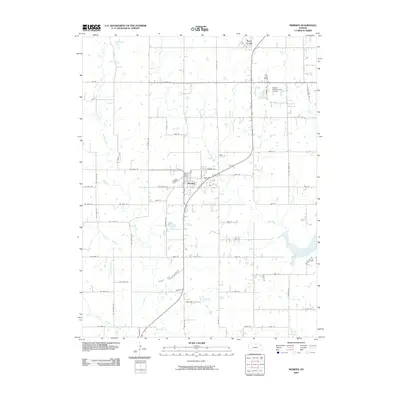
2009 Map of Meriden
USGS Topo · Published 2009About this map
Meriden serves as the central hub of this Kansas landscape, situated at the junction of several rural routes including Main St and Condray St. The town's civic identity is anchored by the Meriden Post Office, while the surrounding Jefferson County countryside is defined by an intricate network of waterways. Multiple branches of Muddy Creek and Rock Creek carve through the agricultural grid, shaping the terrain as they flow toward the substantial waters of Perry Lake in the southeast. This survey captures a moment when traditional land divisions meet modern leisure, evidenced by the Village Greens Golf Course in the northeast. Small bodies of water like Fin and Feather Lake dot the area, providing localized landmarks amidst a system of well-defined section roads like Wyandotte Rd and NE Silver Rd.
Find a feature on this map
65 named features on this map. Tap any name to fly to it.
Don’t see what you’re looking for? This feature index may not catch every label — zoom into the map to look around manually.
Map Details
Editions of this 2009 Meriden Map
This is the sole edition of this map. No revisions or reprints were ever made.
Other maps of this area

1886 · Oskaloosa
USGS Topo · 1:125,000

1888 · Oskaloosa
USGS Topo · 1:125,000

1889 · Topeka
USGS Topo · 1:125,000

1894 · Oskaloosa
USGS Topo · 1:125,000

1894 · Topeka
USGS Topo · 1:125,000

1949 · Perry
USGS Topo · 1:24,000

1950 · Perry
USGS Topo · 1:24,000

1950 · Kansas City
USGS Topo · 1:250,000

1950 · Topeka
USGS Topo · 1:24,000

1950 · Grantville
USGS Topo · 1:24,000