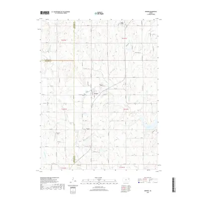
2018 Map of Meriden
USGS Topo · Published 2018About this map
Meriden serves as the central hub of this Jefferson County landscape, situated at the intersection of a grid-like road network and surrounded by a drainage system including Rock Creek and Claywell Cr. The town's historical foundations are evident in the presence of the Meriden Cem and Saint Aloysius Cem, which sit west and south of the town center. The topography is defined by the winding paths of several streams, notably Muddy Cr and its various forks, which carve through the land before feeding into the northern reaches of Perry Lake in the southeast corner.
Find a feature on this map
82 named features on this map. Tap any name to fly to it.
Don’t see what you’re looking for? This feature index may not catch every label — zoom into the map to look around manually.
Map Details
Editions of this 2018 Meriden Map
This is the sole edition of this map. No revisions or reprints were ever made.
Other maps of this area

1886 · Oskaloosa
USGS Topo · 1:125,000

1888 · Oskaloosa
USGS Topo · 1:125,000

1889 · Topeka
USGS Topo · 1:125,000

1894 · Oskaloosa
USGS Topo · 1:125,000

1894 · Topeka
USGS Topo · 1:125,000

1949 · Perry
USGS Topo · 1:24,000

1950 · Perry
USGS Topo · 1:24,000

1950 · Kansas City
USGS Topo · 1:250,000

1950 · Topeka
USGS Topo · 1:24,000

1950 · Grantville
USGS Topo · 1:24,000