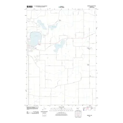
2010 Map of Meriden
USGS Topo · Published 2010About this map
Meriden serves as the primary settlement on this agricultural landscape in Waseca County, anchored by the Meriden Post Office and a grid of rural section roads. The terrain is defined by a significant chain of glacial lakes, including the expansive Clear Lake and Goose Lake, which dominate the western and central portions of the sheet. At the north end, the Watkins Lake Dam regulates flow through Watkins Lake, while Crane Creek drains the northeastern corner. Local history is preserved in several small burial grounds scattered across the townships, such as Woodville Cemetery near the lakeshore and the more remote Brase Cemetery and Saint Paul's Lutheran Cemetery. This 2010 survey reflects a region where traditional land use and recreation coexist, evidenced by the proximity of Kieslers Campground to the water's edge and the surrounding network of farm-to-market roads like Lemond Rd and County Hwy 18.
Find a feature on this map
37 named features on this map. Tap any name to fly to it.
Don’t see what you’re looking for? This feature index may not catch every label — zoom into the map to look around manually.
Map Details
Editions of this 2010 Meriden Map
This is the sole edition of this map. No revisions or reprints were ever made.
Other maps of this area

1953 · Saint Paul
USGS Topo · 1:250,000

1954 · Mason City
USGS Topo · 1:250,000

1957 · Mason City
USGS Topo · 1:250,000

1958 · Mason City
USGS Topo · 1:250,000

1959 · Saint Paul
USGS Topo · 1:250,000

1962 · Morristown
USGS Topo · 1:24,000

1962 · Saco
USGS Topo · 1:24,000

1962 · Meriden
USGS Topo · 1:24,000

1962 · Medford West
USGS Topo · 1:24,000

1966 · Waseca
USGS Topo · 1:24,000