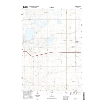
2016 Map of Meriden
USGS Topo · Published 2016About this map
Waseca and the smaller settlement of Meriden anchor this portion of south-central Minnesota, where a complex network of wetlands and small lakes defines the landscape. The county line between Waseca Co and Steele Co runs vertically through the eastern half, separating the municipal hub of Waseca from the agricultural reaches to the east. Several bodies of water including Clear Lake, Goose Lake, and Watkins Lake are interspersed with low-lying terrain and drainage features like Crane Creek. The map provides significant detail for genealogists, marking several local burial sites such as Woodville Cemetery near the city center, Saint Paul's Lutheran Cemetery, Karsten Cemetery, and Brase Cemetery. The transition from the urban streets of Waseca to the rural section lines of the surrounding townships illustrates the enduring character of the region's agricultural and township organization.
Find a feature on this map
76 named features on this map. Tap any name to fly to it.
Don’t see what you’re looking for? This feature index may not catch every label — zoom into the map to look around manually.
Map Details
Editions of this 2016 Meriden Map
This is the sole edition of this map. No revisions or reprints were ever made.
Other maps of this area

1953 · Saint Paul
USGS Topo · 1:250,000

1954 · Mason City
USGS Topo · 1:250,000

1957 · Mason City
USGS Topo · 1:250,000

1958 · Mason City
USGS Topo · 1:250,000

1959 · Saint Paul
USGS Topo · 1:250,000

1962 · Morristown
USGS Topo · 1:24,000

1962 · Saco
USGS Topo · 1:24,000

1962 · Meriden
USGS Topo · 1:24,000

1962 · Medford West
USGS Topo · 1:24,000

1966 · Waseca
USGS Topo · 1:24,000