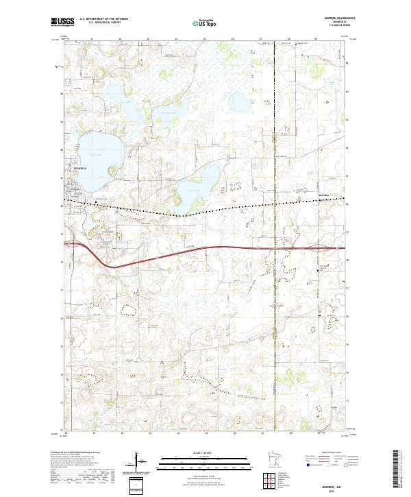
2022 Map of Meriden
USGS Topo · Published 2022About this map
The eastern edges of Waseca and the small community of Meriden anchor this landscape along the border of Waseca and Steele Counties. This portion of southern Minnesota is defined by a glacial prairie pothole topography, visible in the dense cluster of water bodies like Clear Lake, Goose Lake, and Rice Lake. The map reveals a highly structured grid of section lines and township roads that organize the agricultural land between these wetlands and the Little Le Sueur River in the south. Genealogists and local historians will find several burial grounds documented, including Saint Pauls Lutheran Cem, Woodville Cem, and Brase Cem, which reflect the area's rural settlement patterns. The presence of Old US Hwy 14 and Old Hwy 14 provides a direct link to early 20th-century transportation corridors that once bypassed many of these smaller lakes.
Find a feature on this map
93 named features on this map. Tap any name to fly to it.
Don’t see what you’re looking for? This feature index may not catch every label — zoom into the map to look around manually.
Map Details
Editions of this 2022 Meriden Map
This is the sole edition of this map. No revisions or reprints were ever made.
Other maps of this area

1953 · Saint Paul
USGS Topo · 1:250,000

1954 · Mason City
USGS Topo · 1:250,000

1957 · Mason City
USGS Topo · 1:250,000

1958 · Mason City
USGS Topo · 1:250,000

1959 · Saint Paul
USGS Topo · 1:250,000

1962 · Morristown
USGS Topo · 1:24,000

1962 · Saco
USGS Topo · 1:24,000

1962 · Meriden
USGS Topo · 1:24,000

1962 · Medford West
USGS Topo · 1:24,000

1966 · Waseca
USGS Topo · 1:24,000