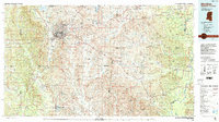
1984 Map of Meridian
USGS Topo · Published 1990About this map
Meridian stands as the central hub of this East Mississippi and West Alabama borderland, where the Illinois Central Gulf RR, Southern Ry, and Meridian and Bigbee RR converge. This rail and highway network connects a series of outlying settlements like Toomsuba, Chunky, and Cuba, many of which were established as rural trading points and water stops. To the north, the Meridian Naval Air Station and the Okatibbee State Wildlife Management Area surrounding Okatibbee Lake represent a mid-century shift toward military aviation and planned water management. Moving east across the state line into Alabama, the landscape softens into the timberlands of the Kinterbish State Wildlife Management Area and the river bottoms of the Tombigbee River. Local genealogy and community history are preserved in markers like Memorial Park Cem, Savannah Grove Ch, and Key Sch.
Find a feature on this map
148 named features on this map. Tap any name to fly to it.
Don’t see what you’re looking for? This feature index may not catch every label — zoom into the map to look around manually.
Map Details
Editions of this 1984 Meridian Map
3 editions found
Other maps of this area

1921 · Meridian
USGS Topo · 1:48,000

1923 · Meridian
USGS Topo · 1:62,500

1929 · Epes
USGS Topo · 1:48,000

1932 · Epes
USGS Topo · 1:62,500

1948 · Mc Dowell
USGS Topo · 1:24,000

1949 · Mc Dowell
USGS Topo · 1:24,000

1953 · Montgomery
USGS Topo · 1:250,000

1953 · Andalusia
USGS Topo · 1:250,000

1953 · Hattiesburg
USGS Topo · 1:250,000

1953 · Meridian
USGS Topo · 1:250,000