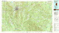
1984 Map of Meridian
USGS Topo · Published 1990About this map
The city of Meridian serves as the focal point of this regional study, which bridges the border between Mississippi and Alabama during the mid-1980s. The landscape is defined by its water systems, including the Chickasawhay River and the extensive Okatibbee Lake, which is surrounded by the Okatibbee State Wildlife Management Area. To the north, the Meridian Naval Air Station marks a significant military presence in Lauderdale County, while smaller rail-adjacent towns like Stonewall, Quitman, and Enterprise line the corridor to the south.
Find a feature on this map
89 named features on this map. Tap any name to fly to it.
Don’t see what you’re looking for? This feature index may not catch every label — zoom into the map to look around manually.
Map Details
Editions of this 1984 Meridian Map
3 editions found
Other maps of this area

1921 · Meridian
USGS Topo · 1:48,000

1923 · Meridian
USGS Topo · 1:62,500

1929 · Epes
USGS Topo · 1:48,000

1932 · Epes
USGS Topo · 1:62,500

1948 · Mc Dowell
USGS Topo · 1:24,000

1949 · Mc Dowell
USGS Topo · 1:24,000

1953 · Montgomery
USGS Topo · 1:250,000

1953 · Andalusia
USGS Topo · 1:250,000

1953 · Hattiesburg
USGS Topo · 1:250,000

1953 · Meridian
USGS Topo · 1:250,000