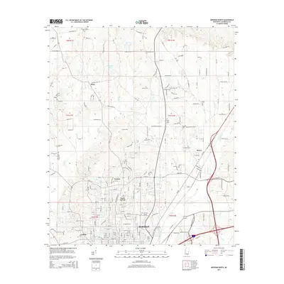
2015 Map of Meridian North
USGS Topo · Published 2015About this map
Meridian and its northern suburbs are charted here in 2015, revealing a landscape where urban development transitions into the timbered hills of Lauderdale County. The map provides significant genealogical value through its many recorded burial sites, including the centrally located Magnolia Cem and the historically significant Confederate Cem near Marion. The terrain is shaped by numerous waterways such as Souwashee Cr and Nanabe Cr, which have long influenced the positioning of settlements like Poplar Springs and Houston. Local transportation remains anchored by routes like Jimmie Rodgers Pkwy, named for the legendary local musician, and the rail-aligned community of Complete. From the residential streets of the city to the rural crossroads at Bailey, this survey captures the infrastructure of a modern Southern regional hub while preserving the names of its established family and community landmarks.
Find a feature on this map
139 named features on this map. Tap any name to fly to it.
Don’t see what you’re looking for? This feature index may not catch every label — zoom into the map to look around manually.
Map Details
Editions of this 2015 Meridian North Map
This is the sole edition of this map. No revisions or reprints were ever made.
Other maps of this area

1921 · Meridian
USGS Topo · 1:48,000

1923 · Meridian
USGS Topo · 1:62,500

1953 · Meridian
USGS Topo · 1:250,000

1957 · Meridian
USGS Topo · 1:250,000

1957 · Chunky
USGS Topo · 1:62,500

1962 · Daleville
USGS Topo · 1:24,000

1962 · Lauderdale
USGS Topo · 1:24,000

1962 · Center Hill
USGS Topo · 1:24,000

1965 · Meridian
USGS Topo · 1:250,000

1971 · Vimville
USGS Topo · 1:24,000