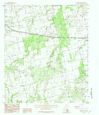
1984 Map of Merkel East
USGS Topo · Published 1984About this map
Merkel and Tye anchor this West Texas landscape, showing the expansion of settlements along the transport corridors of Taylor County during the late 1970s and early 1980s. The map illustrates a transitional rural economy where traditional agriculture exists alongside an Oil Field, several instances of a Gravel Pit, and specialized infrastructure like the Sewage Disposal Ponds. The presence of small localities like Mt Pleasant and Cozart provides valuable data for genealogists tracing family footprints in the area.
Find a feature on this map
17 named features on this map. Tap any name to fly to it.
Don’t see what you’re looking for? This feature index may not catch every label — zoom into the map to look around manually.
Map Details
Editions of this 1984 Merkel East Map
2 editions found
Other maps of this area

1890 · Abilene
USGS Topo · 1:125,000

1891 · Anson
USGS Topo · 1:125,000

1892 · Abilene
USGS Topo · 1:125,000

1893 · Roby
USGS Topo · 1:125,000

1893 · Anson
USGS Topo · 1:125,000

1893 · Sweetwater
USGS Topo · 1:125,000

1954 · Big Spring
USGS Topo · 1:250,000

1954 · Abilene
USGS Topo · 1:250,000

1957 · Hawley
USGS Topo · 1:62,500

1957 · Merkel
USGS Topo · 1:62,500