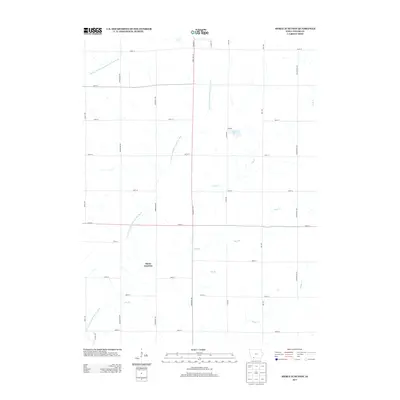
2013 Map of Merle Junction
USGS Topo · Published 2013About this map
Merle Junction sits at the heart of this southwestern Iowa agricultural landscape, positioned within a network of drainage ways that feed the larger river systems of Taylor County. The terrain is defined by the repetitive, north-south section roads such as Tennessee Ave and Winchester Ave, which cut across the winding paths of the E Fork One Hundred and Two River and the Middle Br One Hundred and Two River. These watercourses, along with smaller tributaries like Hog Br and Ash Br, illustrate the natural irrigation of the Missouri River basin. Near the center of the sheet, Wilson Lake provides a localized water feature accessed via Park Rd. The map documents a sparsely populated rural district where long-established section lines and county routes, including Co Hwy J35, still dictate the movement of people and commerce through the farmland.
Find a feature on this map
30 named features on this map. Tap any name to fly to it.
Don’t see what you’re looking for? This feature index may not catch every label — zoom into the map to look around manually.
Map Details
Editions of this 2013 Merle Junction Map
This is the sole edition of this map. No revisions or reprints were ever made.
Other maps of this area

1940 · Blockton
USGS Topo · 1:62,500

1940 · Bedford
USGS Topo · 1:62,500

1943 · Bedford
USGS Topo · 1:62,500

1943 · Blockton
USGS Topo · 1:62,500

1955 · Nebraska City
USGS Topo · 1:250,000

1957 · Nebraska City
USGS Topo · 1:250,000

1958 · Nebraska City
USGS Topo · 1:250,000

1980 · Corning South
USGS Topo · 1:24,000

1980 · Gravity
USGS Topo · 1:24,000

1980 · Merle Junction
USGS Topo · 1:24,000