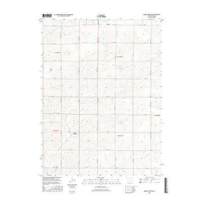
2015 Map of Merle Junction
USGS Topo · Published 2015About this map
Merle Junction sits at the center of this Taylor County landscape, where the branching tributaries of the One Hundred and Two River system carve a network of valleys through the Iowa farmland. The topography is defined by the Middle Br One Hundred and Two River and the E Fork One Hundred and Two River, alongside smaller waterways like Hog Br and Honey Cr. These drainage patterns dictated the original settlement and road layouts, which primarily follow a rigid section-line grid despite the rolling elevation changes. In the northern reaches, the town of Lenox establishes a small urban footprint, while Clearfield anchors the eastern edge. Local genealogy is anchored by sites such as Tando-Winslow Cem and Conway Cem, while Wilson Lake provides a notable point of interest among the agricultural fields.
Find a feature on this map
36 named features on this map. Tap any name to fly to it.
Don’t see what you’re looking for? This feature index may not catch every label — zoom into the map to look around manually.
Map Details
Editions of this 2015 Merle Junction Map
This is the sole edition of this map. No revisions or reprints were ever made.
Other maps of this area

1940 · Blockton
USGS Topo · 1:62,500

1940 · Bedford
USGS Topo · 1:62,500

1943 · Bedford
USGS Topo · 1:62,500

1943 · Blockton
USGS Topo · 1:62,500

1955 · Nebraska City
USGS Topo · 1:250,000

1957 · Nebraska City
USGS Topo · 1:250,000

1958 · Nebraska City
USGS Topo · 1:250,000

1980 · Corning South
USGS Topo · 1:24,000

1980 · Gravity
USGS Topo · 1:24,000

1980 · Merle Junction
USGS Topo · 1:24,000