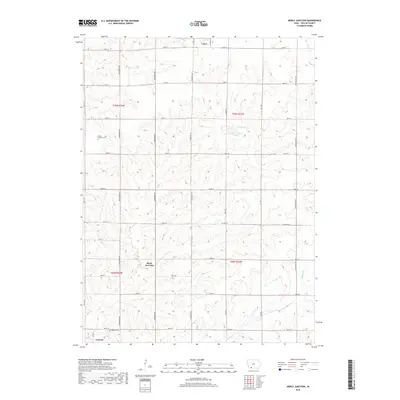
2018 Map of Merle Junction
USGS Topo · Published 2018About this map
Lenox anchors the northern edge of this Taylor County landscape, where the town grid meets the rolling agricultural terrain of southern Iowa. The area is defined by a dense network of sectional roads and the headwaters of Honey Cr, which drains toward the southwest. This 2018 survey provides essential detail for local historians and genealogists, pinpointing the locations of the Tando-Winslow Cem and the Conway Cem near the southern settlement of Conway. The namesake Merle Junction sits centrally, marking a transition point between the townships of t70n r33w and t69n r33w. Notable water features include Wilson Lake, situated among the contour-plowed fields that characterize the region's modern land use. The map also traces the path of Co Hwy J23 as it cuts east-west across the central prairie.
Find a feature on this map
31 named features on this map. Tap any name to fly to it.
Don’t see what you’re looking for? This feature index may not catch every label — zoom into the map to look around manually.
Map Details
Editions of this 2018 Merle Junction Map
This is the sole edition of this map. No revisions or reprints were ever made.
Other maps of this area

1940 · Blockton
USGS Topo · 1:62,500

1940 · Bedford
USGS Topo · 1:62,500

1943 · Bedford
USGS Topo · 1:62,500

1943 · Blockton
USGS Topo · 1:62,500

1955 · Nebraska City
USGS Topo · 1:250,000

1957 · Nebraska City
USGS Topo · 1:250,000

1958 · Nebraska City
USGS Topo · 1:250,000

1980 · Corning South
USGS Topo · 1:24,000

1980 · Gravity
USGS Topo · 1:24,000

1980 · Merle Junction
USGS Topo · 1:24,000