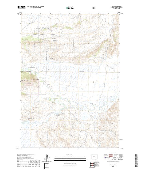
2021 Map of Merna
USGS Topo · Published 2021About this map
Merna and its surrounding rangeland sit at the heart of this Western Wyoming landscape, where the foothills of the Wyoming Range meet the expansive high plains. The settlement of Merna is the primary focal point, situated amidst a complex network of drainage systems and high ridges. The map illustrates a distinctive topography defined by Beaver Ridge to the north and the rising terrain of Merna Butte to the west, where the boundary of the Bridger National Forest begins.
Find a feature on this map
36 named features on this map. Tap any name to fly to it.
Don’t see what you’re looking for? This feature index may not catch every label — zoom into the map to look around manually.
Map Details
Editions of this 2021 Merna Map
This is the sole edition of this map. No revisions or reprints were ever made.
Other maps of this area

1907 · Gros Ventre
USGS Topo · 1:125,000

1910 · Gros Ventre
USGS Topo · 1:125,000

1939 · Big Piney
USGS Topo · 1:125,000

1942 · Big Piney
USGS Topo · 1:125,000

1955 · Driggs
USGS Topo · 1:250,000

1955 · Preston
USGS Topo · 1:250,000

1958 · Driggs
USGS Topo · 1:250,000

1958 · Preston
USGS Topo · 1:250,000

1962 · Driggs
USGS Topo · 1:250,000

1962 · Preston
USGS Topo · 1:250,000