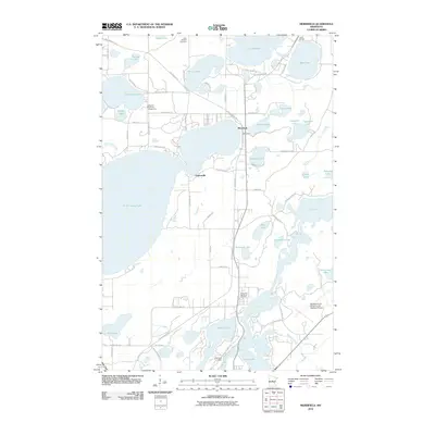
2010 Map of Merrifield
USGS Topo · Published 2010About this map
The settlement of Merrifield sits at the heart of this lake-strewn landscape in Crow Wing County, where recreational and residential development defines the shoreline of North Long Lake and Lake Edward. This 2010 survey illustrates the modernization of a classic Minnesota vacation destination, featuring numerous seasonal landmarks such as Sullivan's Resort and Campground and Hart's RV Park. The area's legacy of timber and outdoor transit is preserved in the route of the Paul Bunyan Trl and the Old Logging Trl, which wind through the woods and wetlands north of the Mississippi River.
Find a feature on this map
69 named features on this map. Tap any name to fly to it.
Don’t see what you’re looking for? This feature index may not catch every label — zoom into the map to look around manually.
Map Details
Editions of this 2010 Merrifield Map
This is the sole edition of this map. No revisions or reprints were ever made.
Other maps of this area

1915 · Brainerd
USGS Topo · 1:62,500

1916 · Pillager
USGS Topo · 1:62,500

1918 · Brainerd
USGS Topo · 1:62,500

1919 · Pillager
USGS Topo · 1:62,500

1953 · Brainerd
USGS Topo · 1:250,000

1954 · Baxter
USGS Topo · 1:24,000

1957 · Brainerd
USGS Topo · 1:250,000

1958 · Brainerd
USGS Topo · 1:250,000

1959 · Trommald
USGS Topo · 1:24,000

1959 · Pelican Lake
USGS Topo · 1:24,000