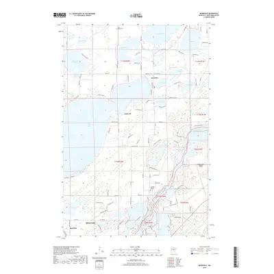
2019 Map of Merrifield
USGS Topo · Published 2019About this map
The Mississippi River winds through this central Minnesota landscape, defining the transition between the expanding urban centers of Brainerd and Baxter and the lake-dotted townships to the north. Settlement patterns follow the dense concentration of glacial lakes, with Merrifield and Legionville serving as focal points for the surrounding recreational and residential landscape. The importance of the regional infrastructure is clear, highlighted by the sprawling grounds of the Brainerd Lakes Regional Airport and the network of county roads like Co Rd 3 that connect the waterfront communities.
Find a feature on this map
111 named features on this map. Tap any name to fly to it.
Don’t see what you’re looking for? This feature index may not catch every label — zoom into the map to look around manually.
Map Details
Editions of this 2019 Merrifield Map
This is the sole edition of this map. No revisions or reprints were ever made.
Other maps of this area

1915 · Brainerd
USGS Topo · 1:62,500

1916 · Pillager
USGS Topo · 1:62,500

1918 · Brainerd
USGS Topo · 1:62,500

1919 · Pillager
USGS Topo · 1:62,500

1953 · Brainerd
USGS Topo · 1:250,000

1954 · Baxter
USGS Topo · 1:24,000

1957 · Brainerd
USGS Topo · 1:250,000

1958 · Brainerd
USGS Topo · 1:250,000

1959 · Trommald
USGS Topo · 1:24,000

1959 · Pelican Lake
USGS Topo · 1:24,000