
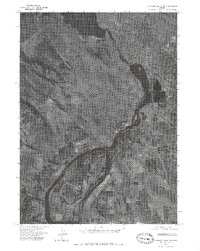
1975 Map of Merrill NW
USGS Topo · Published 1979About this map
Altamont defines the residential and commercial landscape of the Klamath Falls vicinity during the mid-1970s, as shown on this orthophotograph. This aerial-based survey provides a visual record of the region's agricultural intensity and the precise layout of its irrigation and road networks. The grid-like patterns of rural farming parcels are bisected by the water course of the Lost River, which meanders through the southern half of the quadrangle. Near the intersection of these agricultural fields and the encroaching suburban outskirts lies Henley, serving as a focal point for the surrounding community. This specific edition uses photographic imagery from 1975 to illustrate the transition between the dense residential development of the northwest and the expansive, productive valley floor to the southeast.
Find a feature on this map
3 named features on this map. Tap any name to fly to it.
Don’t see what you’re looking for? This feature index may not catch every label — zoom into the map to look around manually.
Map Details
Editions of this 1975 Merrill NW Map
This is the sole edition of this map. No revisions or reprints were ever made.
Other maps of this area

1889 · Klamath
USGS Topo · 1:250,000

1894 · Klamath
USGS Topo · 1:250,000

1955 · Klamath Falls
USGS Topo · 1:250,000

1957 · Merrill
USGS Topo · 1:62,500

1957 · Swan Lake
USGS Topo · 1:62,500

1957 · Klamath Falls
USGS Topo · 1:62,500

1957 · Modoc Point
USGS Topo · 1:62,500

1958 · Klamath Falls
USGS Topo · 1:250,000
1975 · Klamath Falls NE
USGS Topo · 1:24,000
1985 · Dairy
USGS Topo · 1:24,000