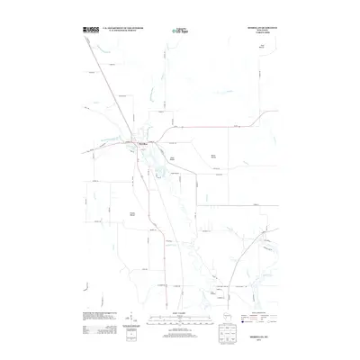
2013 Map of Merrillan
USGS Topo · Published 2013About this map
The village of Merrillan serves as the central hub of this Jackson County landscape, situated at a junction where the water and rail networks meet. The village is defined by its relationship with Halls Creek, which feeds into Oakwood Lake right at the town center before continuing south toward its confluence with the Black River. This 2013 survey shows a terrain marked by distinctive geological features, including the cluster of Trow Mounds in the northeast and Bruce Mound to the east, which dominate the local topography alongside Stanley Mound and Small Mound.
Find a feature on this map
69 named features on this map. Tap any name to fly to it.
Don’t see what you’re looking for? This feature index may not catch every label — zoom into the map to look around manually.
Map Details
Editions of this 2013 Merrillan Map
This is the sole edition of this map. No revisions or reprints were ever made.
Other maps of this area

1924 · Black River Falls
USGS Topo · 1:62,500

1926 · Black River Falls
USGS Topo · 1:62,500

1948 · Fairchild
USGS Topo · 1:62,500

1949 · Fairchild
USGS Topo · 1:62,500

1953 · Neillsville
USGS Topo · 1:62,500

1953 · Eau Claire
USGS Topo · 1:250,000

1958 · Eau Claire
USGS Topo · 1:250,000

1958 · Hatfield
USGS Topo · 1:48,000

1964 · Eau Claire
USGS Topo · 1:250,000
1968 · Black River Falls
USGS Topo · 1:62,500