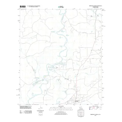
2010 Map of Merryville North
USGS Topo · Published 2010About this map
Merryville sits at the southern edge of this landscape, where the town's northern reaches meet the complex wetlands of the Sabine River valley. The river winds through the western half of the map, creating a series of oxbows and secondary channels including Pole Slough, Eaves Old River, and numerous named bodies of water such as Alligator Lake and Chains Lakes. These natural features dominate the drainage patterns of the area, punctuated by the Bridge Creek system.
Find a feature on this map
45 named features on this map. Tap any name to fly to it.
Don’t see what you’re looking for? This feature index may not catch every label — zoom into the map to look around manually.
Map Details
Editions of this 2010 Merryville North Map
This is the sole edition of this map. No revisions or reprints were ever made.
Other maps of this area

1935 · Wilson Lake
USGS Topo · 1:31,680

1946 · Merryville
USGS Topo · 1:31,680

1947 · Singer
USGS Topo · 1:31,680

1947 · Pujo
USGS Topo · 1:31,680

1947 · Knight
USGS Topo · 1:31,680

1947 · Wilson Lake
USGS Topo · 1:31,680

1947 · Bivens
USGS Topo · 1:31,680

1949 · Evans
USGS Topo · 1:31,680

1952 · Lake Charles
USGS Topo · 1:250,000
1954 · Pujo
USGS Topo · 1:31,680