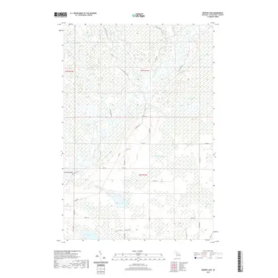
2019 Map of Merwin Lake
USGS Topo · Published 2019About this map
The Manistique River winds through this section of Schoolcraft County, Michigan, defining a landscape of wetlands and northern forests. The southern portion of the quadrangle contains a high concentration of water bodies, including Merwin Lake, Salter Lake, and Palmer Lake. This area is marked by a network of logging and service roads such as the Highwater Truck Trl and Letson Truck Trl, reflecting the region's historical and ongoing ties to the timber industry. A notable inland feature is the Bear Creek Swamp, which dominates the eastern central terrain. Genealogy researchers may find interest in the isolated Woods Cem located north of Rice Rd, while the presence of the Walsh Ditch in the north suggests early 20th-century efforts to manage the water table for land use or resource extraction.
Find a feature on this map
42 named features on this map. Tap any name to fly to it.
Don’t see what you’re looking for? This feature index may not catch every label — zoom into the map to look around manually.
Map Details
Editions of this 2019 Merwin Lake Map
This is the sole edition of this map. No revisions or reprints were ever made.
Other maps of this area

1931 · Manistique River NE
USGS Topo · 1:31,680

1931 · Seul Choix Point NW
USGS Topo · 1:31,680

1931 · Manistique River SE
USGS Topo · 1:31,680

1931 · Manistique River NW
USGS Topo · 1:31,680

1931 · Blaney SW
USGS Topo · 1:31,680

1931 · Manistique River SW
USGS Topo · 1:31,680

1931 · Blaney NW
USGS Topo · 1:31,680

1954 · Escanaba
USGS Topo · 1:250,000

1954 · Sault Sainte Marie
USGS Topo · 1:250,000

1955 · Cheboygan
USGS Topo · 1:250,000