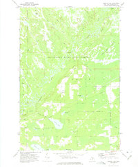
1972 Map of Merwin Lake
USGS Topo · Published 1975About this map
The Manistique River winds in tight, serpentine oxbows through this portion of the Manistique River State Forest in the early 1970s. This landscape in Doyle township is defined by its complex hydrology, where the river meets numerous tributaries like Duck Creek, Clemons Creek, and Bear Creek. The low-lying terrain is characterized by the expansive Bear Creek Swamp to the east and a series of smaller water bodies including Merwin Lake, McIntyre Lake, and Mud Lake. Local history is anchored by the presence of the Woods Sch and the adjacent Woods Cem, providing specific points of interest for genealogists tracing families in this part of Schoolcraft County. Navigation through the timber and wetlands is facilitated by the Highwater Truck Trail and Riverside Truck Trail, while the Merwin Creek Campground and a Boat Ramp indicate the area's recreational use during this era.
Find a feature on this map
33 named features on this map. Tap any name to fly to it.
Don’t see what you’re looking for? This feature index may not catch every label — zoom into the map to look around manually.
Map Details
Editions of this 1972 Merwin Lake Map
This is the sole edition of this map. No revisions or reprints were ever made.
Other maps of this area

1931 · Manistique River NE
USGS Topo · 1:31,680

1931 · Seul Choix Point NW
USGS Topo · 1:31,680

1931 · Manistique River SE
USGS Topo · 1:31,680

1931 · Manistique River NW
USGS Topo · 1:31,680

1931 · Blaney SW
USGS Topo · 1:31,680

1931 · Manistique River SW
USGS Topo · 1:31,680

1931 · Blaney NW
USGS Topo · 1:31,680

1954 · Escanaba
USGS Topo · 1:250,000

1954 · Sault Sainte Marie
USGS Topo · 1:250,000

1955 · Cheboygan
USGS Topo · 1:250,000