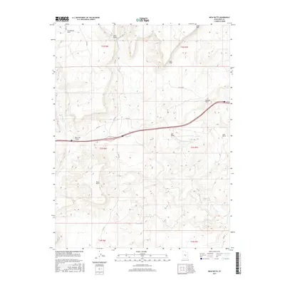
2017 Map of Mesa Butte
USGS Topo · Published 2017About this map
Mesa Butte stands as a prominent landmark in this desert landscape of Emery County, where the high plateaus of central Utah meet the erosional features of the San Rafael Swell. The terrain is defined by dramatic geologic shifts, most notably the towering Coal Cliffs and the jagged edge of Molen Reef. This area serves as a significant drainage basin, with the winding paths of Ivie Cr and Muddy Cr carving through the dry earth and converging near the southern edge of the quadrangle.
Find a feature on this map
27 named features on this map. Tap any name to fly to it.
Don’t see what you’re looking for? This feature index may not catch every label — zoom into the map to look around manually.
Map Details
Editions of this 2017 Mesa Butte Map
This is the sole edition of this map. No revisions or reprints were ever made.
Other maps of this area

1885 · Fish Lake
USGS Topo · 1:250,000

1896 · Fish Lake
USGS Topo · 1:250,000

1925 · Acord Lakes
USGS Topo · 1:62,500

1953 · Emery 4 NE
USGS Topo · 1:24,000

1953 · Emery 1 NE
USGS Topo · 1:24,000

1953 · Emery 1 SE
USGS Topo · 1:24,000

1956 · Salina
USGS Topo · 1:250,000

1960 · Salina
USGS Topo · 1:250,000

1962 · Salina
USGS Topo · 1:250,000
1968 · Walker Flat
USGS Topo · 1:24,000