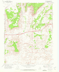
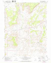
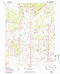
1968 Map of Mesa Butte
USGS Topo · Published 1972About this map
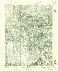
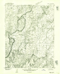
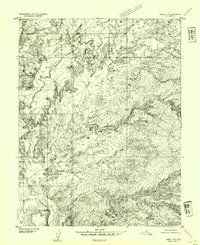
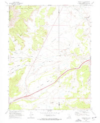
Coal Cliffs and the jagged Coal Cliffs Reef dominate this high-desert landscape in central Utah, revealing a transition into a modern era of infrastructure development. At the time of this 1968 field check, a major highway was noted as being under construction across the southern half of the quadrangle, carving through Red Valley and bridging Ivie Creek. Despite these modern incursions, the map documents an older economy of resource extraction and livestock transit. The Cowboy Mine is tucked into the northern canyons, while the drainage of Muddy Creek remains the primary topographical feature, leading down to the Lone Tree Crossing and a Gaging Station. The geography is defined by prominent landforms like Mesa Butte and Sand Bench, separated by a complex network of ephemeral waterways including Christiansen Wash and Mulligan Wash.
Find a feature on this map
19 named features on this map. Tap any name to fly to it.
Don’t see what you’re looking for? This feature index may not catch every label — zoom into the map to look around manually.
Map Details
Editions of this 1968 Mesa Butte Map
3 editions found
Other maps of this area

1885 · Fish Lake
USGS Topo · 1:250,000

1896 · Fish Lake
USGS Topo · 1:250,000
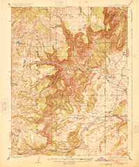
1925 · Acord Lakes
USGS Topo · 1:62,500
1953 · Emery 4 NE
USGS Topo · 1:24,000
1953 · Emery 1 NE
USGS Topo · 1:24,000
1953 · Emery 1 SE
USGS Topo · 1:24,000

1956 · Salina
USGS Topo · 1:250,000

1960 · Salina
USGS Topo · 1:250,000

1962 · Salina
USGS Topo · 1:250,000
1968 · Walker Flat
USGS Topo · 1:24,000