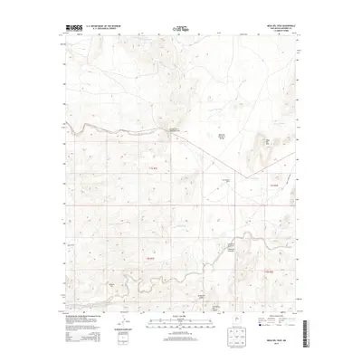
2013 Map of Mesa Del Yeso
USGS Topo · Published 2013About this map
Old Stapleton Ranch and Sabino Ranch anchor this high-desert landscape of eastern Socorro County, where life is defined by the drainage networks of the Chihuahuan Desert. The terrain is a complex of significant arroyos, including the Arroyo de Alamillo and Arroyo de la Parida, which carve through the land between landmarks like Mesa del Yeso and Johnson Hill. In the southern portion of the map, the settlements of Cerrillos del Coyote and the small canyon communities of Cañoncito de la Uva and Cañoncito Colorado show the persistent footprint of ranching and remote habitations. The presença of Ojo de la Parida suggests the importance of water sources in this arid valley, while the WSMR S Route 3802 indicates the modern infrastructure associated with the White Sands Missile Range area.
Find a feature on this map
22 named features on this map. Tap any name to fly to it.
Don’t see what you’re looking for? This feature index may not catch every label — zoom into the map to look around manually.
Map Details
Editions of this 2013 Mesa Del Yeso Map
This is the sole edition of this map. No revisions or reprints were ever made.
Other maps of this area

1906 · Socorro
USGS Topo · 1:62,500

1916 · La Joya
USGS Topo · 1:125,000

1952 · San Anacia
USGS Topo · 1:24,000

1952 · La Joya
USGS Topo · 1:24,000

1952 · Becker SW
USGS Topo · 1:24,000

1954 · Socorro
USGS Topo · 1:250,000

1958 · Socorro
USGS Topo · 1:250,000

1959 · Loma De Las Canas
USGS Topo · 1:24,000

1959 · Socorro
USGS Topo · 1:24,000

1959 · Mesa Del Yeso
USGS Topo · 1:24,000