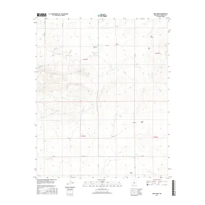
2017 Map of Mesa Draw
USGS Topo · Published 2017About this map
Cedar Grove Cem stands as a quiet cultural anchor in this high-desert landscape of Torrance County, New Mexico. The terrain is defined by a series of significant drainage systems and high points, including Mesa Draw, Big Draw, and Lion Canyon, which carve through the elevations near Eisenhart Hill. The local infrastructure is largely comprised of a network of named trails and roads such as Piro Trl, Seneca Trl, and Alabaster Rd, reflecting a grid-based land management system.
Find a feature on this map
31 named features on this map. Tap any name to fly to it.
Don’t see what you’re looking for? This feature index may not catch every label — zoom into the map to look around manually.
Map Details
Editions of this 2017 Mesa Draw Map
This is the sole edition of this map. No revisions or reprints were ever made.
Other maps of this area

1917 · Estancia
USGS Topo · 1:125,000

1954 · Torreon
USGS Topo · 1:62,500

1954 · Socorro
USGS Topo · 1:250,000

1956 · Mountainair
USGS Topo · 1:62,500

1958 · Socorro
USGS Topo · 1:250,000

1962 · Socorro
USGS Topo · 1:250,000

1972 · Gran Quivira
USGS Topo · 1:24,000

1972 · Chupadera
USGS Topo · 1:24,000

1972 · Bigbee Draw
USGS Topo · 1:24,000

1972 · Abo
USGS Topo · 1:24,000