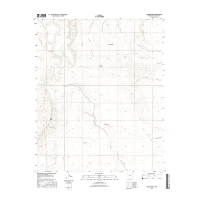
2017 Map of Mesas Mojinas
USGS Topo · Published 2017About this map
Mesas Mojinas dominates this arid landscape in Valencia County, where the topography is defined by high tablelands and the complex drainage of the Arroyo Comanche. The map reveals a land managed for water, dotted with numerous named catchment systems such as the Gurule Tank, Alderete Tank, and Esparauza Tank, which are essential for livestock in this high-desert environment. These features, along with the Sabina Tank and Number 4 Tank, suggest a long history of ranching and land use across the township lines of T6N R3W and T5N R2W.
Find a feature on this map
21 named features on this map. Tap any name to fly to it.
Don’t see what you’re looking for? This feature index may not catch every label — zoom into the map to look around manually.
Map Details
Editions of this 2017 Mesas Mojinas Map
This is the sole edition of this map. No revisions or reprints were ever made.
Other maps of this area

1917 · Cerro Verde
USGS Topo · 1:125,000

1952 · Belen SW
USGS Topo · 1:24,000

1952 · Belen NW
USGS Topo · 1:24,000

1952 · Rio Puerco
USGS Topo · 1:24,000

1954 · South Garcia SE
USGS Topo · 1:24,000

1954 · Socorro
USGS Topo · 1:250,000

1956 · South Garcia
USGS Topo · 1:62,500

1956 · Mesa Aparejo
USGS Topo · 1:62,500

1958 · Socorro
USGS Topo · 1:250,000

1962 · Socorro
USGS Topo · 1:250,000