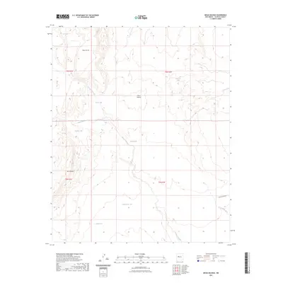
2023 Map of Mesas Mojinas
USGS Topo · Published 2023About this map
Mesas Mojinas rises as the central topographic feature in this arid landscape, located in Valencia County. The terrain is defined by a network of drainage channels including Arroyo Comanche, which winds through the central and southern sections, and Arroyo Salado further north. Human presence is largely marked by water management and resource extraction, illustrated by scattered reservoirs such as Gurule Tank, Esparauza Tank, and Alderete Tank. A single named thoroughfare, Marble Quarry Rd, provides access to the southeastern corner of the quadrangle near Arroyo Monte Belen, hinting at the industrial activity that has historically shaped this part of New Mexico. The geography is further characterized by the prominent elevations of Mesa Carrizo in the northwest and Mesa Aparejo to the southwest, while Ojito Spring remains a notable natural water source in this high-desert environment.
Find a feature on this map
20 named features on this map. Tap any name to fly to it.
Don’t see what you’re looking for? This feature index may not catch every label — zoom into the map to look around manually.
Map Details
Editions of this 2023 Mesas Mojinas Map
This is the sole edition of this map. No revisions or reprints were ever made.
Other maps of this area

1917 · Cerro Verde
USGS Topo · 1:125,000

1952 · Belen SW
USGS Topo · 1:24,000

1952 · Belen NW
USGS Topo · 1:24,000

1952 · Rio Puerco
USGS Topo · 1:24,000

1954 · South Garcia SE
USGS Topo · 1:24,000

1954 · Socorro
USGS Topo · 1:250,000

1956 · South Garcia
USGS Topo · 1:62,500

1956 · Mesa Aparejo
USGS Topo · 1:62,500

1958 · Socorro
USGS Topo · 1:250,000

1962 · Socorro
USGS Topo · 1:250,000